Showing posts with label poor maintenance. Show all posts
Saturday, 6 August 2011
Plastered
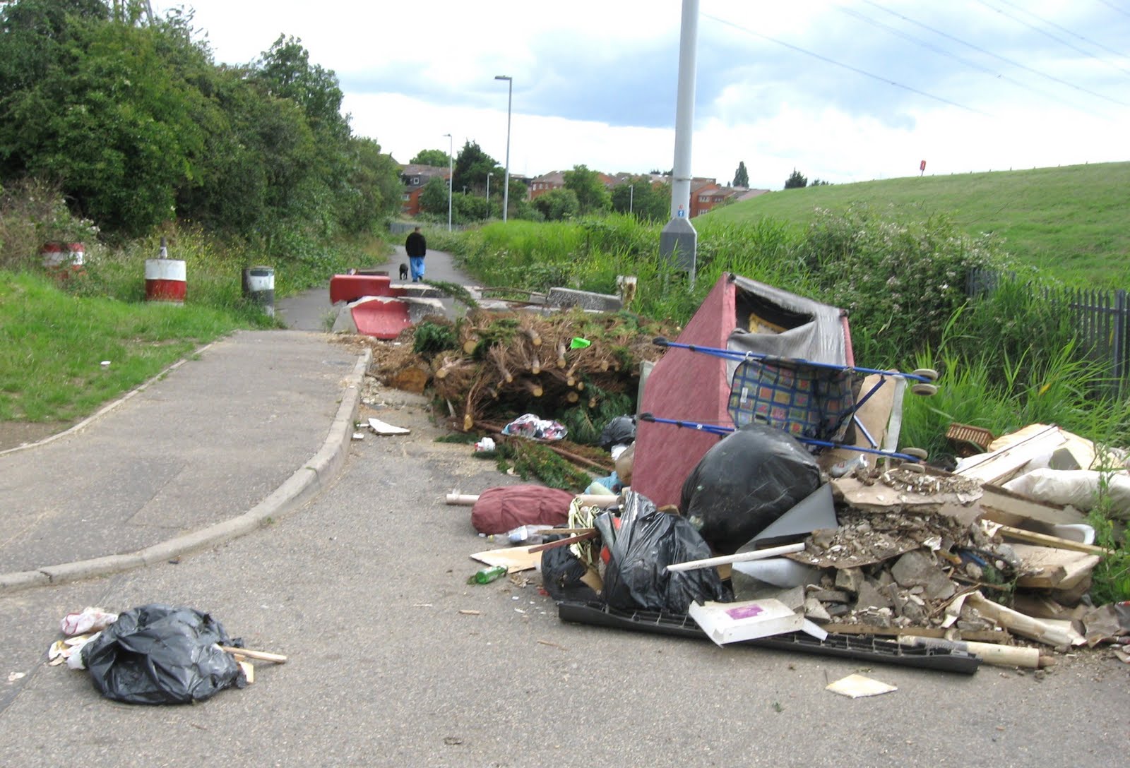
On November 23 I photographed this fly-tipped heap of plaster, presumably dumped by a white van man builder. It’s just off Walthamstow High Street, on Buxton Road.
Nine months later it’s maturing nicely.
Monday, 20 June 2011
In A Lonely Place (Bike Week Day 2)
Bike week day two. The perfect setting for a leisurely jaunt along the Lea Valley. I was coming south from Ponders End via the traffic-free road that runs beside the Edmonton Incinerator (sorry, new name: London Waste Eco Park) when I linked up with the towpath at Cook's Ferry. Here, by Advent Way, I spotted another top class piece of cycling infrastructure for anyone joining the towpath from the path that runs beside the North Circular.
(Below) Continue on under the North Circular. The dimensions of the cycle path and the adjacent footway are almost Dutch. The absence of illumination and the inadequate drainage aren't.
(Below) Emerging from the underpass and meeting the towpath: more high quality signing, well maintained.
(Below) A new sign, perfect for Bike Week. Towpath closed 16 May - 22 July. A map shows the very lengthy diversion around Banbury Reservoir. However, no diversion signs are installed anywhere on the route, so it's easy to get lost (as I did on the first bit). The towpath at this point accumulated a number of cyclists and ramblers, who'd suddenly found their planned day out disrupted.
(Below) The one-hundred-metres-long blocked-off section of towpath, photographed through a gap. Quite why it could not be left open on Saturdays and Sundays isn't clear, as there is no plant on site and the route is no more dangerous than it usually is. I feel sure that in the Netherlands they would maintain access for cyclists and pedestrians.
(Below) Let's go on the diversion. The cycle path on Argon Road leads to every cyclist's favourite sign. From here all you have to do is negotiate a roundabout with very fast traffic coming off the North Circular, pedal along Harbet Road, passing another bleak slice of industrial estate, then take the right turn at the roundabout by Folly Lane.
(Below) At last, back to the open road and traffic-free Folly Lane, a popular cycling leisure route maintained to the standard you'd expect in the London Borough of Waltham Forest.
(Below) Continue on under the North Circular. The dimensions of the cycle path and the adjacent footway are almost Dutch. The absence of illumination and the inadequate drainage aren't.
(Below) Emerging from the underpass and meeting the towpath: more high quality signing, well maintained.
(Below) A new sign, perfect for Bike Week. Towpath closed 16 May - 22 July. A map shows the very lengthy diversion around Banbury Reservoir. However, no diversion signs are installed anywhere on the route, so it's easy to get lost (as I did on the first bit). The towpath at this point accumulated a number of cyclists and ramblers, who'd suddenly found their planned day out disrupted.
(Below) The one-hundred-metres-long blocked-off section of towpath, photographed through a gap. Quite why it could not be left open on Saturdays and Sundays isn't clear, as there is no plant on site and the route is no more dangerous than it usually is. I feel sure that in the Netherlands they would maintain access for cyclists and pedestrians.
(Below) Let's go on the diversion. The cycle path on Argon Road leads to every cyclist's favourite sign. From here all you have to do is negotiate a roundabout with very fast traffic coming off the North Circular, pedal along Harbet Road, passing another bleak slice of industrial estate, then take the right turn at the roundabout by Folly Lane.
(Below) At last, back to the open road and traffic-free Folly Lane, a popular cycling leisure route maintained to the standard you'd expect in the London Borough of Waltham Forest.
Saturday, 7 May 2011
Take a trip down Walthamstow Avenue
No, this is not the aftermath of an earthquake. It’s the footway on Walthamstow Avenue E4. Just another scene from what the pedestrian-friendly Council is pleased to call Walk’em Forest.
Not that it’s much smoother by bike… Essex Road E17 (below)
Friday, 11 March 2011
A safe, segregated cycle path in Waltham Forest
Travelling eastbound on Lea Bridge Road (A104) cyclists entering the London Borough of Waltham Forest have the chance to enjoy a safe, segregated 'shared use' path built according to the very highest British design principles.
A continuous white line keeps pedestrians to the left, while cyclists enjoy a red cycle path to the right of the white line. This section approaching Argall Way is particularly impressive.


(Below)This irresponsible cyclist has clearly gone over the line and strayed into the pedestrian area. How are we cyclists ever going to win respect from BMW owners with people like this always letting us down?

(Below) To complete your cycling enjoyment, why not turn left at the traffic lights and go 'round the bend'. Here you can plunge into the magical world of the London Cycling Campaign's prize-winning 'best new cycle route in London' for 2001. Perhaps there should be a picnic here to celebrate its tenth anniversary and to admire the way in which it has matured with age.
All photos taken yesterday.
A continuous white line keeps pedestrians to the left, while cyclists enjoy a red cycle path to the right of the white line. This section approaching Argall Way is particularly impressive.
(Below)This irresponsible cyclist has clearly gone over the line and strayed into the pedestrian area. How are we cyclists ever going to win respect from BMW owners with people like this always letting us down?
(Below) To complete your cycling enjoyment, why not turn left at the traffic lights and go 'round the bend'. Here you can plunge into the magical world of the London Cycling Campaign's prize-winning 'best new cycle route in London' for 2001. Perhaps there should be a picnic here to celebrate its tenth anniversary and to admire the way in which it has matured with age.
All photos taken yesterday.
Thursday, 3 February 2011
Paying LIP service to cycling: Waltham Forest’s ‘Local Implementation Plan’
A substandard and poorly maintained 'advisory' cycle lane leading to a pinch point and a mini-roundabout on a dangerous bend, just after a vehicle-activated advisory speed sign which has not been working for several years. The northbound A112, the major north-south communication transport spine in Waltham Forest.
The London Borough of Waltham Forest has just published its new Local Implementation Plan (LIP), which comes into force, aptly, on All Fools Day (April 1st). The council is obliged by law to produce this LIP, which is intended to show how it intends to implement the Mayor’s Transport Strategy (MTS) at a local level. Core goals of the MTS include ‘Reducing transport’s contribution to climate change’ as well as wider, vaguer ones (‘Improving transport opportunities for all Londoners’).
The LIP covers a wide range of topics including air pollution, ‘road safety’, ‘greener transport’, ‘regeneration’ and ‘the accessibility of key centres’, which encompass a broad range of transport issues and modes. For today I want to concentrate exclusively on cycling and return to other aspects, including walking, another day.
The first thing to note is that this LIP does not have a section specifically devoted to cycling. This is quite unlike Waltham Forest’s first LIP (2005) which contained a lengthy and detailed ‘Cycle action plan’ some 38 pages long. The new LIP devotes only a handful of scattered paragraphs to cycling (2.6.2, 2.9B, 3.4.7, and 4.B), although the whole document is threaded with vague references to ‘encouraging cycling’ and ‘improvements to the cycling network’.
This new LIP reveals that things are even worse for cycling locally than has previously been acknowledged. According to TfL, modal share in Waltham Forest over the period 2006-2009 was 0.8%. That’s right, less than one per cent. By any standards this is a catastrophically failed borough for cycling. Naturally the LIP is not interested in asking why that might be.
If you didn’t live in Waltham Forest and if you had no knowledge of conditions on its streets or its transport history, you could read this LIP and easily be fooled into thinking that Waltham Forest Council was indeed a progressive local authority. For example it is boldly asserted that ‘The Council recognises that streets have more functions than simply catering for vehicular movements’ (2.7.1), which sounds progressive but in reality means the other function of streets is to provide parking for all those vehicles when they cease their movements (like here, for example).
The same section also boldly asserts that ‘It is necessary to find an appropriate balance between the different users the street caters for.’ Our old friend ‘balance’, which in practise simply means that provision may be made for pedestrians and cyclists but only when this does not significantly impede that much greater priority, ‘smoothing traffic flow’. In any case what is desperately needed in London is not a cosmetic ‘balance’ between the immensely privileged motorist and the marginalised pedestrian and cyclist but a complete reversal of the hegemony of the private car – in other words, removing the private car completely from city centres, re-allocating carriageway space on major roads for segregated cycle paths (what the Dutch know as ‘bike grids’ and which were central to the early reversal of car dependency in the Netherlands) and making car travel in residential areas circuitous and inconvenient. Although Waltham Forest has a small number of road closures, it remains very easy to rat-run through residential areas if you have local knowledge. And every lunatic speeding mini-cab driver and white van man does.
Waltham Forest has residential areas where 45 per cent of households don’t own a car, yet every single street in those areas is devoted to the primacy of motor vehicle flow and on-street car parking. If you choose not to own a car and cycle or walk all you get in return is systematic discrimination at every level, from funding and infrastructure to enforcement and maintenance. Waltham Forest Council will even steal the footway from outside your house for car parking.
It’s also the case that it is not possible to judge the claims of this LIP without very detailed knowledge. For example, in section 3.4.2 (‘Neighbourhoods’) a number of traffic schemes are described, of which number 5 is ‘Westward Road area, E4’. The LIP states that ‘The Council is proposing to implement a number of measures to improve the overall area’, measures which will result in an ‘improved pedestrian and cycling environment in the vicinity’. This is simply a lie. The fundamental motivation of this scheme is ‘smoothing traffic flow’ and it is car-centric to its bones.
The Westward Road area is one where free on-street car parking has reached saturation point, resulting in aggressive confrontations between drivers when they meet and there isn’t space to pass or pull in. In these incidents each driver believes it’s the other driver’s responsibility to reverse. The council’s traffic planners have decided to resolve such conflict not by removing the obstructive on-street car parking but by introducing a one-way street network and by allowing drivers to park on the pavement. The Westward Road area scheme is totally car-centric and comprehensively degrades the environment for pedestrians and cyclists; you can read my critique of it here. The LIP reveals that this anti-cycling, anti-walking scheme, which promotes yet more on-street car parking, parking for wider vehicles like 4X4s, and convenient motoring, will cost £360,000.
In its summary of Waltham Forest’s transport objectives the LIP asserts (2.10) that ‘The emphasis is on encouraging a modal shift from private car travel to more sustainable modes’. This is the kind of claim which successive transport documents over many years have committed the council to, while it has gone in exactly the opposite direction in practice. ‘Encouraging walking and cycling’ was at the heart of The Waltham Forest Green Charter (1996) – a charter which has now been vaporized by the council officers – as well as Waltham Forest’s Local Agenda 21 Action Plan (2000) – which has likewise joined the ranks of the disappeared. They served their historic purpose (Green campaigners vigorously wagged their tails and yapped excitedly) and can now safely be forgotten.
But wait! Section 2.4 is headed ‘Local Problems, Challenges and Opportunities’. A good opportunity to consider why cycling is doing so poorly in Waltham Forest? I’m afraid not. This section simply dissolves into blather and froth. Cycling isn’t even mentioned.
Now you might think that a council with such a mediocre record for cycling would want to understand why. It could begin, for example, by asking if the targets set out in the last LIP have been met. After all, back in 2005 Waltham Forest was prepared to contemplate the intoxicating possibility that cycling in the borough might even become ‘as popular as in Holland’ (2005 LIP, page 165). In fact even those rudimentary and non-controversial vehicular cycling measures which were proposed six years ago, such as ASLs at every signalised junction and cycle gaps at all road closures, have still not been accomplished. Something as quite basic as cycle stands outside all post offices and libraries has not been achieved (meanwhile millions of pounds have been spent on infrastructure for motorists). And whatever happened to the ‘smartcard’ bike shed which was going to be in place at Blackhorse Road station by 2007? The list of broken promises is a lengthy one.
It seems to me that if Waltham Forest is remotely serious about increasing its modal share for cycling (and the LIP aspires to 2% modal share in Waltham Forest by 2013, which on the one hand is paltry and inadequate but which in terms of local conditions is fantastically ambitious) then it needs to ask itself what’s gone wrong in the past and how this might be addressed.
To do this I think the council’s transport planners need to ask two things.
Firstly, how can non-cyclists be persuaded both to take up cycling and then to keep cycling and not give up?
Secondly, why do people prefer to drive rather than cycle, and how can this situation be reversed?
Every survey ever taken shows that people are afraid to cycle in traffic, with a large preference for segregated infrastructure. The feelings of vehicular cyclists locally are not dissimilar:
Key findings from cyclists surveyed during the 2009 Tour de Waltham Forest.
"Bad drivers" and "scary road conditions" are the biggest general barrier to cycling (to 79%).
Greenways (Epping Forest, the Lea Valley etc.) are the best thing about cycling in Waltham Forest (63%).
A hostile road environment is the biggest barrier to novice cyclists
'A hostile road environment' - cycling infrastructure like this, in other words. The westbound A503. The cycle lane shown in the first photo is then diverted around parking bays some 200 metres further west, as shown below.
However, this LIP nowhere acknowledges the core issue of subjective safety, let alone seeks to address it. Interestingly there is a glancing commitment to ‘Investigate the possibility of segregated cycle lanes on roads with higher speeds’ (p. 89) which is well worth quoting in a response to this LIP. However it is very hard to regard this as a serious commitment in view of what is currently happening on the A503 (Forest Road), where on a section of road with traffic going faster than 40 mph in a 30 mph limit the cycle lane has been seized for car parking and cyclists pushed closer to overtaking traffic. It’s also worth remembering that the 2005 LIP contained a similarly perfunctory one-sentence commitment to ‘Segregated cycle facilities’, which worked out in practice like this.
The LIP signally fails to address the issue of subjective safety. But objective safety isn’t doing all that well either. Cycling casualties in Waltham Forest were 71 in 2000, 60 in 2002, 53 in 2004 and for 2006-2008 ‘an average of approximately 62 accidents a year’ (p. 88), rising to 93 in 2009. The LIP target is 51 casualties by 2013/14 and 41 casualties by 2020. The only way these targets are likely to be reached is if cycling shrinks still further in the borough. If the LIP target of a 2% modal share by 2013 is achieved (let alone the Mayor’s, which basically require an extra 3,000 cycling trips every day for each year leading up to 2026) then cycling casualties are likely to rocket, not because of the supposed carelessness of ‘novices’ but rather because the fundamental problem is cyclists being exposed to high volumes of motor traffic where significantly large numbers of drivers behave in a dangerously inattentive or dangerously reckless way. Any planning document which purports to ‘encourage cycling’ in a vehicular environment while failing to acknowledge the widespread criminal negligence of drivers simply doesn’t understand either cycling or the scale of the problem.
All that this LIP has on offer for cyclists is ‘soft’ measures like cycle training and ‘hard’ infrastructure in the form of traffic calming and more 20 mph zones. However desirable these might be, there is simply no statistical correlation between measures like the ones proposed and increased numbers of cyclists. This is not something the LIP acknowledges, so it is theoretically flawed in its proposals for increasing cycling. Nor does it demonstrate the slightest interest in acknowledging or diagnosing the failure of past promises to ‘encourage cycling’. Instead all we get is more empty aspiration, floating free of the real world (the LIP boasts it has been developed in consultation with the London Cycling Campaign, so I suppose the strategy vaccuum at its heart ought not to be a surprise).
There is the promise of more permeability, which is particularly insolent in the light both of this and also the borough’s ongoing programme of more and more one-way streets without contraflow lanes or contraflow signing. All residential areas of Waltham Forest are gradually being turned into one-way gyratory systems, which may deter some rat-running, but are fundamentally antithetical both to cycling desire lines and comfort/safety (many drivers hate getting stuck behind a cyclist on a one-way street and will either blow their horns or overtake in an aggressive and reckless manner). Pedestrians are promised more refuges, but these frequently create pinch points that create extra road danger or discomfort for cyclists.
Depressingly, it is finally revealed that the cycling infrastructure proposed for cycling-hostile Whipps Cross Road, to be paid for with Olympic funding, is to be a ‘cycle lane’ (p. 54). No details are supplied. It will not exactly be an enormous surprise if it turns out to be 1.5 metres wide and advisory. Whipps Cross Road is precisely the kind of road where a segregated cycle path on the Dutch template is both desirable and possible; simply painting a narrow cycle lane on the carriageway is most unlikely to attract new cyclists to this unpleasant road filled with high volumes of fast moving motor vehicles.
Perhaps the most positive ‘hard’ piece of infrastructure on offer in the LIP is to be found on p. 52: ‘Ruckholt Road New Pedestrian and Cycle Bridge’:
This proposed new bridge will be introduced to improve walking and cycling facilities in Ruckholt Road across Marshall Road and the Network Rail/CTRL railway tracks.
Apparently
The new bridge will provide a new 3 metre wide route for westbound cyclists and pedestrians.
Moreover
The footbridge and accompanying infrastructure will be DDA compliant and offer excellent opportunities for wheelchair users who have hitherto found it difficult or impossible to get into the Lea Valley from the Leyton and South Walthamstow area.
Well this new bridge may meet the criteria of the Disability Discrimination Act but it certainly doesn’t live up to Dutch standards. In the first place cyclists need to have a gap at the side so that you don't catch your handlebars as you ride. This needs to be at least half a metre wide for safety, potentially making this 3 m bridge actually more a 2 m bridge. As a ‘shared use’ bridge the likelihood is that a continuous white line will be painted down the middle, giving 1.5 m each to pedestrians and cyclists. Contrast this with the Netherlands where unidirectional cycle paths are a minimum of 2.5 m wide and pedestrian paths are separate and usually 2 m wide. With space to separate pedestrians and cyclists, a Dutch bridge of this type would be designed to a minimum width of 6 m. So this bridge is substandard even before it is built, and if pedestrians with companions use it, the likelihood is that they will stray into the cycle path.
Also bear in mind that this fabulous piece of infrastructure will first require cyclists to encounter this.
Lastly, there is some guff about how ‘High quality cycle networks such as LCN+ and Greenways offer safe, convenient, predictable and reliable access to local destinations’ in such idyllic cycling centres as Wood Green, Hackney and Stratford (no doubt Mr Grumpy can show us some photographs of these cycling nirvanas, because as we know once you leave Waltham Forest the infrastructure just gets better and better).
Yes, Waltham Forest will be rushing to catch up on its neighbours with a delightful network of Greenways – you know, like the ones suitable for fans of Andrei Tarkovsky.
Of course if money is going to be pumped into Waltham Forest’s miserably neglected rights of way network this is A Good Thing, but the striking thing about the map of Greenways on p. 58 is that the routes are not strategic, most of them are indirect, and none of them connects to other Greenways in the borough. To access them you will first have to cycle on hostile ‘A’ roads or car-clogged backstreets, neither of which offer attractive environments for any but the most traffic-hardened vehicular cyclist.
It also needs to be noted that ‘the planned industrial growth at Blackhorse Lane and the Upper Lea Valley’ (p. 55) and the ‘redevelopment potential’ of industrial areas in the vicinity of Lea Bridge Road (p.53) are likely to result in increased numbers of lorries and commercial vehicles on strategic routes where cycling is currently being suppressed.
In short, as far as ‘encouraging cycling’ is concerned there is nothing in this LIP which hasn’t been tried in the past and which has comprehensively failed to engage the interest of the non-cycling population of the London Borough of Waltham Forest. And for existing cyclists, conditions are actually getting worse in various ways. The vehicular cycling infrastructure is getting more dangerous in lots of little ways, the proliferation of one-way streets is making cycling more inconvenient, and the huge numbers of drivers talking on mobile phones, distracted by their SatNavs or simply behaving recklessly makes cycling in Waltham Forest all too often a hazardous and unpleasant activity.
The second major theoretical shortcoming in this LIP is that there is no point at all in claiming to ‘encourage cycling’ if you are not also prepared to address the question of why people prefer to drive rather than cycle, and consider how this situation can be reversed. This is something the Dutch started doing back in 1975 but which no one in Britain is very interested in considering, least of all transport planners.
This LIP is fundamentally flawed because it is fundamentally car-centric. Let us say no more about local instances of the blazing hypocrisy of ‘encouraging a modal shift from private car travel to more sustainable modes’ while spending almost half a million pounds re-allocating street space for car parking at the expense of cyclists and pedestrians.
The new LIP contains no data at all showing the year-on-year rise in car ownership in Waltham Forest, nor (unlike the 2005 LIP) does it contain any raw data about motor vehicle flow or lawless speeds on selected local streets. It says nothing about the council’s relentless promotion of car parking at the expense of pedestrians by virtue of seizing literally hundreds of local footways for car parking, and it says nothing about the council’s relentless promotion of easier traffic flow on car-saturated local streets through the medium of more and more one-way streets, at the expense of direct cycle routes. Nor does it mention the Council's halving of the cost of a CPZ permit for local drivers.
With reference to High Road Leytonstone/Leytonstone Road E11, it acknowledges that ‘This road represents a key route into Stratford and congestion along the road impacts on the reliability of a number of bus routes’ (p. 53) but the ‘corridor scheme’ proposed remains fundamentally car-centric. The promise to ‘enhance the public realm’ simply means planting a few trees, changing the design of lighting columns and tidying up those sections of footway which are not devoted to parking bays. The corridor scheme does nothing to reduce motor vehicle traffic flow and parking, and it conveniently blots out the Council’s squalid history on this road of surrendering all its past policies about traffic restraint.
The Waltham Forest LIP is from beginning to end a totally car-centric document. It will meet the requirements of the Mayor’s Transport Strategy, because that is equally vacuous and car-centric. This LIP does absolutely nothing for cycling and it will predictably fail to get non-cycling residents of Waltham Forest on their bikes. But I very much doubt if any of the 'essential car user' officers involved in drawing up this LIP really cares.
It’s also an astonishingly slovenly document, littered with spelling mistakes and bad grammar (‘visa versa’ and numerous other entertaining howlers). The Council’s officers can’t even be bothered to attend to the English language, let alone cycling infrastructure. Their contempt for the public shines through - this is a shoddy document, obviously done in a hurry. Whereas the 2005 LIP was a meaty document 248 pages long, this new LIP is just 105 pages in length. This new LIP will serve its bureaucratic purpose and can then be put on the shelf to gather dust and be forgotten.
My favourite Freudian slip in this LIP is the one that says that an ‘improvement scheme’ is expected to result in ‘smother traffic flow’ (p. 61). Exactly. What this LIP underlines is that Waltham Forest’s car-sick, car-centric, grey fleet transport planners intend to go on smothering the borough in motor vehicles and make an area which already has one of the highest levels of ill-health in Greater London even sicker, more polluted and car-choked than it already is.
Saturday, 1 January 2011
N(ice)
The metaphysics of traffic signing are among the great philosophical challenges of our time, wouldn’t you say?
I didn’t notice this sign when this section of the cycling-friendly A112 was full of slush and ice, and it would be very Waltham Forest to stick it up once all the snow and ice had melted. But in any case, why here? This location is no different to any other as far as the weather is concerned. Indeed, the A roads always clear much faster than the side roads.
It would be much better to put signs like these on the borough’s off-road cycle paths, with the additional words: NO GRIT EVER USED ON CYCLING INFRASTRUCTURE.
Tuesday, 21 December 2010
Cycling during an exciting time for cycling
Spot the bike logo in the cycle lane
This is an exciting time for cycling. It is at the heart of the Mayor’s Transport Strategy (MTS) and some London boroughs are already leading the way by improving conditions for cycling and promoting its benefits.
There is growing public enthusiasm for cycling in Outer London. More people are seeing the bike as a viable and attractive alternative to the car. In a recent survey, 58 per cent of Outer Londoners said they are considering cycling more over the coming year.
Clearly outer London will not be like the rest of Britain, where recent research by the Department for Transport indicated that For every three respondents who had tried cycling to work, two had reverted back to using their car.
It’s a mystery why some novices lose their enthusiasm for cycling. The full version of Delivering the benefits of cycling in Outer London is packed with photographs of happy cyclists (although many of them evidently feel the need to wear helmets, which is odd when you consider that cycling in motor traffic is very, very safe). And let’s face it, what could be more relevant to cycling in an Outer London borough like Waltham Forest than pics of people cycling on a sunny day through Hyde Park?
I have been out on my bike today and, yes, as you can see, this is an exciting time for cycling.
(below) one-metre wide cycle lane with left-turning bus. Selborne Road E17.
(below) Walthamstow High Street cycle stand
Saturday, 11 December 2010
A cycle route in winter
The light at this time of year brings out the sheer quality of Waltham Forest’s prize winning cycle routes.
Essex Road E17.
And on the adjacent footway there’s another little celebration of the success which Kier and the council have in jointly working to bring about clean streets.
Yup, the London Borough of Waltham Forest where even the garbage comes with an uplifting slogan.
Thursday, 2 December 2010
Cycle blogging on thin ice
Tuesday, 30 November 2010
Would you like some ice with your cycle lane?
Forest Road (A503) westbound, yesterday. The narrow cycle lane has ice in it all the way from the junction with Greenleaf Road to Wolsey Avenue. The advisory speed sign outside the adjacent police station helpfully gives you the speed of drivers who are flouting the 30 mph speed limit. Or it would do if it hadn’t been broken for weeks.
Mr Grumpy passed this way before me, commenting The source of water wasn't obvious, it looked as if it came from some hardy soul cleaning their car in an adjacent street.
No, no, Mr Grumpy! The water is bubbling up from beneath the road surface and has been for days. This is yet another case of Australian ice.
Wednesday, 24 November 2010
Crap cycling in Bath
Cyclists say their commuting has been thrown into hazardous chaos by the closure of a key footbridge.
The 19th century Victoria Bridge across the River Avon on the edge of the city centre has been closed indefinitely by Bath and North East Somerset Council.
The footbridge - the cables and beams of which are corroded - was shut in mid-October for safety reasons.
CycleBath member John Lucas said: “The bridge is a highly important route for cyclists in the west of the city, being the only off-road route in the area, and is the route I and many others use to reach the city centre from Oldfield Park.
“It is also well used by pedestrians, including children going to Hayesfield School. The alternatives for both pedestrians and cyclists are horrendous - long diversions on roads that are not safe or pleasant for either to use. To the east this is the main road route to Green Park. To the west it is the Destructor Bridge, which is one way so only legally usable in one direction, and which can only be accessed by the main roads and goes through areas that many would not wish to travel through. Further to the west of this the alternative is Windsor Bridge, a very busy road that many cyclists would not wish to use.”
The group’s chair Malcolm Dodds added: “The council says that it regards cyclists as its second highest priority when planning and spending on transport, but too often it feels like we are treated as second class citizens.”
Fellow cyclist Tony Ambrose said: “The state of Bath for pedestrians and cyclists is shameful. We seem to be stuck in the last century whilst the rest of the UK and Europe have been busy civilising their historic city centres. Whilst the council talks the good talk about the environment all they do is make it more difficult, dangerous and unpleasant for people to get around on foot or by bike.”
Just like the London Borough of Waltham Forest, then!
The 19th century Victoria Bridge across the River Avon on the edge of the city centre has been closed indefinitely by Bath and North East Somerset Council.
The footbridge - the cables and beams of which are corroded - was shut in mid-October for safety reasons.
CycleBath member John Lucas said: “The bridge is a highly important route for cyclists in the west of the city, being the only off-road route in the area, and is the route I and many others use to reach the city centre from Oldfield Park.
“It is also well used by pedestrians, including children going to Hayesfield School. The alternatives for both pedestrians and cyclists are horrendous - long diversions on roads that are not safe or pleasant for either to use. To the east this is the main road route to Green Park. To the west it is the Destructor Bridge, which is one way so only legally usable in one direction, and which can only be accessed by the main roads and goes through areas that many would not wish to travel through. Further to the west of this the alternative is Windsor Bridge, a very busy road that many cyclists would not wish to use.”
The group’s chair Malcolm Dodds added: “The council says that it regards cyclists as its second highest priority when planning and spending on transport, but too often it feels like we are treated as second class citizens.”
Fellow cyclist Tony Ambrose said: “The state of Bath for pedestrians and cyclists is shameful. We seem to be stuck in the last century whilst the rest of the UK and Europe have been busy civilising their historic city centres. Whilst the council talks the good talk about the environment all they do is make it more difficult, dangerous and unpleasant for people to get around on foot or by bike.”
Just like the London Borough of Waltham Forest, then!
Tuesday, 23 November 2010
Autumn comes to the Chingford Road cycle lane
Autumn leaves and a collapsed ‘roadworks ahead’ sign strewn along the generously wide cycle lane.
The A112, northbound.
Friday, 19 November 2010
Cycle access: cycling not advised
This is what ‘permeability’ is all about, is it not? A clearly marked out cycle lane which leads to a gap that isn’t wide enough to accommodate handlebars (let alone one of those cargo bikes that funny foreigners use). Buxton Road E17.
Yikes! Not just foreigners. Waltham Forest says: don’t bother cycling out here ‘ndru’.
(I am sorry to say ‘ndru’ has fallen for all that nonsense about the Netherlands being better for cycling than Britain.)
Saturday, 13 November 2010
Another student of crap cycling and walking in Waltham Forest!
Alan has been out enjoying the local scenery and discovering some exciting local cycling and walking infrastructure.
I feel duty bound to point out that if Alan and his companion had kept going and crossed the junction with Forest Road they would have come to this magnificent ‘shared use’ provision on Woodford New Road (below). Yes, crap Waltham Forest council can’t even be bothered to keep its white lining well maintained, let alone see to it that vegetation is cut back. Not that it really matters, because only the most diehard cyclists would want to use convoluted and circuitous provision like this, which leads on to a lonely underpass labyrinth of crumbling cycle paths, broken lighting in tunnels, and scampering rats.

I feel duty bound to point out that if Alan and his companion had kept going and crossed the junction with Forest Road they would have come to this magnificent ‘shared use’ provision on Woodford New Road (below). Yes, crap Waltham Forest council can’t even be bothered to keep its white lining well maintained, let alone see to it that vegetation is cut back. Not that it really matters, because only the most diehard cyclists would want to use convoluted and circuitous provision like this, which leads on to a lonely underpass labyrinth of crumbling cycle paths, broken lighting in tunnels, and scampering rats.
Tuesday, 9 November 2010
Can you spot the bicycle?
Maude Road E17, yesterday in the rain. It’s the awesome London Cycle Network again, with a bike logo painted on the road surface and a little blue sign saying it leads on to the even greater glory of the National Cycle Network (enjoy). This route has also in the past received an ecstatic thumbs-up from Sustrans.
Waltham Forest council fails to maintain its cycling infrastructure in all kinds of ways. The slippy, slimy leaves in November will in due course be replaced by snow and ice, and when it comes nothing will be done to clear the dedicated cycle crossing at the end of this road. That’s assuming it’s not already been rendered unusable by contractors!
Wednesday, 3 November 2010
Thursday, Friday, Saturday, Sunday, Monday…
Saturday, 30 October 2010
Broken glass
The broken glass around one of the two cycle stands in the pedestrianised area outside the International supermarket at the St James Street end of the High Street was there on Thursday, it was still there on Friday and it was still there today. Yet the High Street is supposed to be cleaned and swept daily from Tuesday-Saturday.
Wednesday, 20 October 2010
car-centric Transport for London is the enemy of cycling
A year ago this was a cycle lane. Now this section of the A503 in Walthamstow has been re-allocated for car parking bays, with the cycle lane moved closer to overtaking traffic (below). A killer design.
Here’s one small example of how Transport for London (TfL) wastes money. In a recent tube strike
at one Tube station - Brixton - three guides were paid £240 to escort one cyclist three miles to The Mall in central London.
At Clapham Common, four commuters on their bikes found themselves escorted by three guides and a Transport for London (TfL) traffic controller, whose job it was to ensure the roads were not blocked by the large numbers of people turning to their bikes.
These risibly low numbers (comparable to the Cycle Friday farce) show once again how few non-cycling Londoners actually want to try out cycling. But it’s also completely in character for car-centric Transport for London to fret about cyclists getting in the way of drivers.
Here’s the problem. Huge sums of money are being squandered promoting cycling in London, yet the infrastructure just isn’t there. Transport for London purports to be the friend of the cyclist but the one thing it won’t do is put the interests of cyclists before the interests of car drivers, or re-allocate road space from cars to cyclists. TfL is institutionally on the side of car dependency, and it continues actively to encourage greater car dependency. Cyclists (and pedestrians) are treated as a subordinate species, who must never be allowed to slow down motor vehicles. London’s entire transport infrastructure is designed to prioritise the car driver over the cyclist and the pedestrian.
Some examples.
It's striking how much cycle promotion there is around London these days. You can't get on a tube or bus without seeing posters exhorting you to cycle.
And lots of people do want to cycle. But then come the practicalities. A question we just received on our Yahoo! group was: "What is a good way to cycle from Dollis Hill to Stanmore?" This cyclist has been on the TfL journey planner, and selected "bike only", and got the suggestion to go up the A5 and over the 50mph (in practice 70mph) Staples Corner flyover with it's terrifying motorway-style slip roads. And one has to answer his question, sorry, but it isn't actually possible to cycle from Dollis Hill to Stanmore by an acceptably direct route without going through feasome motorway-style junctions, or breaking the law and riding on pedestrian bridges and pavements. Brent south of the A406 North Circular road is completely cut off from north Brent and the outer suburbs, that is the way it is.
The same message is coming in loud and clear from cycling bloggers across London.
Over in Kennington they talk about TfL’s invitation to die.
In the London Borough of Merton the complaint is that
TfL don't accept they have a problem. They are institutionally car-centric. Listening to them protest about what good they've done for cycling is like listening to an alcoholic say they don't have a drink problem.
I struggle to think of anywhere in London where the safety or convenience of cyclists has ever taken priority over motor traffic, except at the Stockwell Gyratory where they removed one general traffic lane. Yet despite this being the jewel in TfL's crown, Jenny Jones pointed out they've not even solved the problem, which is that the junction is still dangerous and intimidating in both directions, although slightly less so northbound.
In the City a group of cyclists complain:
The problem for cycling in the City is that TfL's understanding of "traffic" equals "motor vehicles". Cycles aren’t part of the traffic, apparently.
If you think London Bridge or Victoria Embankment aren't nice places to cycle, it’s TfL that you have to thank for the road design and not the City. The City wanted to implement some more two-way streets for cycling recently. It was TfL that prevented this.
When it comes to urban road and street space, TfL seems a bit stuck in the dark.
In Haringey there’s the little matter of the Tottenham Hale gyratory redesign.
Question: Why has the scheme not been designed to reduce motor traffic or give preference to walking and cycling?
Answer from Transport for London:
We want to make Tottenham Hale a better place to be. The proposals have been developed with the needs of all modes of transport being important. Removing the one-way system will allow the transformation of the area, making the area a more attractive place to live, work and visit. Our proposals will provide an opportunity to meet the needs of proposed future developments in the area.
One can read this response any number of times and be completely mystified about its meaning. It is the pinnacle of ecofluff nonsense.
Meanwhile TfL and the London Borough of Waltham Forest’s Forest Road Corridor Scheme nears completion.
The spurious justification for this scheme was that it was intended to reduce vehicle speeds in a 30 mph zone. At the last moment, long after the consultation period was over, Waltham Forest’s car-centric transport planners slipped in a little extra to the traffic order – raising the speed limit to 40 mph on a section by a school and where cyclists are forced out closer to overtaking traffic.
Naturally there is no evidence whatsoever that speeds have been reduced. All that has happened is that conditions for cyclists have drastically deteriorated on a major route, further ensuring that cycling in the London Borough of Waltham Forest will never get above a modal share of one per cent. Because no one would want to send their child to school on a bicycle on what was previously an unsafe road and is now, thanks to TfL and Waltham Forest, twice as unsafe.
The only people to benefit from this insane scheme are drivers, who were previously not allowed to park in the road, but who have now had parking bays created specially for them. If you wonder why car ownership in Britain grew from just over 26 million in 2005 to more than 31 million in 2009, a rise of nearly 20% in just four years, look no further than schemes like this.
The cost of this scheme is £222,357 which makes these some of the most expensive parking bays in London. What’s more parking is free and without restrictions of any sort. And some of these new bays have been created outside houses with garages and drives (below).
This scheme was approved by Transport for London – the same TfL whose Director of Integrated Programme Delivery at Transport for London, Ben Plowden, has the impudence to say
It’s staggering that half of all car trips in outer London are less than two miles in length, a distance you can cover on a bike in around 10 minutes.
There’s nothing at all ‘staggering’ about it when bodies like TfL and the London Borough of Waltham Forest implement anti-cycling pro-car projects like the Forest Road Corridor Scheme.
Half a mile down the road incidentally is Wood Street library, one of the many public buildings in the borough which lacks even a single cycle stand. While vast sums are spent on motor vehicle infrastructure, even the most rudimentary cycling infrastructure remains neglected.
And in a final two-fingers to the spurious road safety justification for this insane scheme, the advisory flashing speed sign on Forest Road at the junction with Fernhill Court E17 remains broken. It’s been like that for over two years, but obviously with over £200,000 to spend building car parking bays there’s no money to repair a speed sign.
Monday, 11 October 2010
Challenging cycling environments
The Grumpy Cyclist has been out on National Cycle Network Route One, a glorious piece of infrastructure previously celebrated on this blog here.
Our grumpy cyclist reports:
On the Sustrans website, this diversion is noted with a little exclamation mark and the text "Cycling diversion onto grass". Now that isn't really true is it? A more accurate description would be "Cycling diversion onto terrain that bears some resemblance to a WW1 battlefield".
Cheer up, Mr Grumpy! For a more relaxing ride I recommend the Walthamstow-Chingford ‘quiet route’ where the quality of the infrastructure is, well... what you’d expect from Waltham Forest council.
Our grumpy cyclist reports:
On the Sustrans website, this diversion is noted with a little exclamation mark and the text "Cycling diversion onto grass". Now that isn't really true is it? A more accurate description would be "Cycling diversion onto terrain that bears some resemblance to a WW1 battlefield".
Cheer up, Mr Grumpy! For a more relaxing ride I recommend the Walthamstow-Chingford ‘quiet route’ where the quality of the infrastructure is, well... what you’d expect from Waltham Forest council.
Friday, 8 October 2010
Can you spot the cycle sign?
Endlebury Road, E4. There’s a blue sign telling cyclists following the recommended route to Walthamstow to turn left here into Heathcote Grove but you could easily miss it. Cycle signing, like everything else to do with cycling in Britain, is a cheap after-thought. To save money, signs are attached to the nearest street furniture. Sometimes the signs are on the left of the road (where you are most likely to spot them), sometimes on the right (where they are easily missed). In this instance the sign is attached to the lamppost on the right, but it’s obscured by overgrown vegetation.
Which leads to the second essential rule of cycling infrastructure: neglect. Cycling facilities are not maintained, and signs become obscured or are turned round by vandals, and remain pointing in the wrong direction, sometimes quite literally for years.
Sadly, as I cycled past this overgrown sign (below) I simply couldn’t understand what it was trying to tell me…
Subscribe to:
Posts (Atom)